Donauauwald Neuburg-Ingolstadt
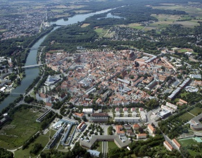
Morphology of the Danube between Neuburg and Ingolstadt
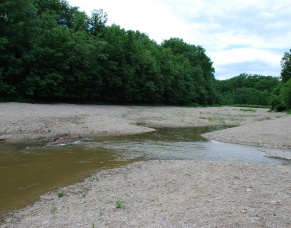
The Danube corresponds in its character with a mountain river, transporting huge amounts of gravel from the Alps to the lowland. Before the regulation in 19 Century there was a richly structured system of major, minor and oxbow lake whose discharge capacity was constantly changing. The dynamics of the Danube led to constantly break new transformation of the landscape. New waters arise islands are formed, silt backwaters, forest area come on and be worn again. Since the last ice age the Danube is a living vein in the large river basin. Since the settlers came along the river the land stream was influencedby humans.
In fact most significant are the changes in the floodplain between the 19th century. As a result of embankments the high biodiversity was destroyed.
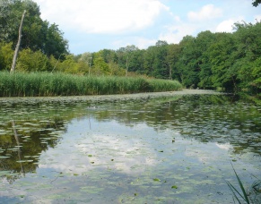
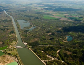
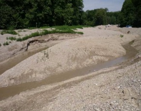
Anthropogenic land use interests in the floodplain for settlement and for agriculture and forestry have led in the past two centuries to serious interventions in river and floodplain. River regulation, such as the Danube corrections around 1830 in conjunction with setting the banks also laid the Danube in a channel-like corset without correction to tributaries, oxbow lakes and floodplain. Today dams and dikes cut the river from ambadoned chanels and the floodplains and cut’s the oxbow lakes and ponds in the floodplain from fresh water supply. Water quality suffers considerable from this shortage, oxbow lakes silt up. Because of the monotone and increased flow velocity the river got deeper and the water table in the floodplain decreased. The outcome of all this were only rare flooding events. To stop a further river bed erosion, the four barrages Bertoldsheim, Bittenbrunn, Bergheim and Ingolstadt were built with the purpose of electricity generation by 1970. Both the sediment continuity, as well as the biological continuity was interrupted and the flow character was lost in the stowage compartments.
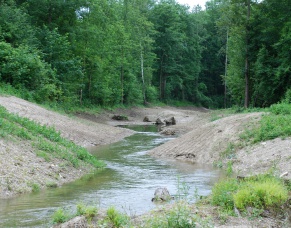
The conservation project “dynamisation of the Danube floodplain between Neuburg and Ingolstadt” could benefit the near-natural dynamic of the Danube and their different habitats. This project includes a bypass waterway around a barrage and parts of the riparian forest could be flooded. Furthermore it circled a low-water management in order to recreate natural fluctuations of the groundwater.